


Follow the map: Interactive campus map
Last modified: Oct 3, 2023, 4:25 p.m.

From: The Division of Campus Planning, Infrastucture, and Facilities
Navigating Virginia Tech’s Blacksburg campus just got easier.
Virtually explore campus and find accessible routes using the interactive campus map.
The map was developed in a collaborative effort by the Division of Information Technology’s Enterprise GIS group; Division of Campus Planning, Infrastructure, and Facilities GIS; Office for Equity and Accessibility; Communications and Marketing; and the Disability Alliance and Caucus.
One of the map’s most notable features is a navigation tool designed to identify routes that exclusively use accessible pathways.
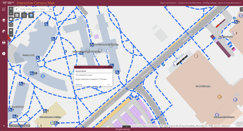
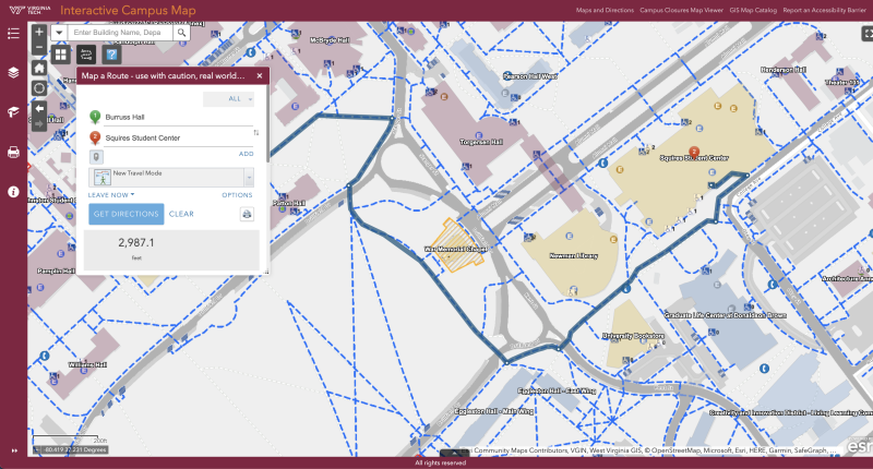
The map also features a navigation tool that allows users to select a starting and ending location, which can be a building, entryway, or specific point on campus. The tool then generates a suggested route that follows only accessible campus pathways.
The routing tool currently only supports accessible routing. Users looking for pedestrian routing are encouraged to use their preferred routing map or mobile app for navigation.
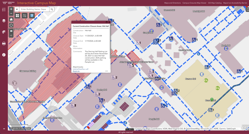
The tool automatically checks for any pathway closures, construction sites, or other potential obstacles and can route the user around those sites. This is especially helpful when navigating around construction sites.
To ensure the navigation tool and other map features satisfied the university’s accessibility requirements and met the practical needs of individuals with disabilities, the map project team worked closely with the Disability Alliance and Caucus (DAC) during the design and testing phases of the project.
The campus community is encouraged to start using the map. User feedback about the map may be directed to gis-space-g@vt.edu.